
Super Copper Deploys Drone Magnetics and Satellite Imagery at Castilla Copper-Gold Project
How Super Copper is leveraging advanced drone magnetics and satellite hyperspectral imaging to map the subsurface roots of an untested, high-grade IOCG system in Chile.
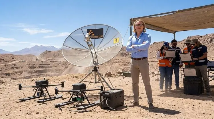
Finding high-grade copper and gold sitting directly on the sun-bleached surface of the Atacama Desert is one thing; the real multi-million-dollar trick is proving how deep those roots actually go. Super Copper Corp. (CSE: CUPR | OTCQB: CUPPF) is answering that exact question by launching a property-wide, high-tech geophysical and hyperspectral campaign at its 100%-owned Castilla copper-gold project in Chile.
Here at JuniorStocks.com, we have featured the company before, keeping a close eye on their milestone-driven exploration strategy, and this latest tactical advancement highlights exactly why the explorer remains a compelling story in the copper space. Rather than rushing in blindly with expensive drill rigs, the company is deploying an integrated three-tier exploration workflow designed to systematically convert Castilla’s extensive surface mineralization into an optimized, ranked inventory of drill-ready targets.
The engineering behind this program relies heavily on high-resolution airborne data to map what lies beneath the desert floor, beginning with a property-wide drone magnetic survey executed by a specialized platform equipped with a total-field cesium-vapour magnetometer. Flying just 50 metres above the rugged terrain, the drone will cover approximately 798 line-kilometres to map the underlying structural faults and deep plumbing systems indicative of a massive Iron Oxide Copper-Gold (IOCG) system. To complement the airborne geophysics, Super Copper Corp. (CSE: CUPR) has partnered with PhotoSat Information Ltd. to deploy high-resolution WorldView-3 satellite hyperspectral imagery across an 85-square-kilometre core area. This satellite array will scan the ground at a crisp two-metre resolution to map up to 12 distinct alteration minerals, including sericite, hematite, and chlorite, essentially fingerprinting the chemical footprint left behind by ancient mineralizing fluids.
Once these airborne and space-borne datasets are processed and integrated, the exploration team will transition directly to the ground to pinpoint the exact locations of the metals. The company plans to deploy an Induced Polarization (IP) and resistivity survey over the highest-priority coincident anomalies identified by the first two phases. Ground IP serves as an essential final layer because it allows geologists to look directly for the electrical signatures of disseminated sulphides and chargeable mineral bodies sitting deep underground, replicating a successful workflow the company previously used to define massive targets at their Cordillera Cobre project.
The prize they are chasing at Castilla is substantial, spanning a massive 7,200-hectare land package roughly 60 kilometres southwest of Copiapó. The project sits precisely along the Atacama Fault System, the exact same regional structural corridor responsible for hosting legendary producing and historic mines like Manto Negro and Osornina. While historical, small-scale underground artisanal miners chased high-grade veins down to about 50 metres depth, the broader property has surprisingly never felt the bite of a modern diamond drill bit. This total lack of historical drilling stands in stark contrast to the property's sensational surface data, where selective grab samples have returned striking grades reaching up to 53.8 grams per tonne of gold and 17.7% copper, alongside widespread iron values that strongly confirm a classic IOCG environment.
Zachary Dolesky, Founder and CEO of Super Copper, emphasized that while Castilla has already produced some of the most striking surface signatures in their portfolio, the project has historically lacked the modern geophysical coverage needed to vector those signatures into the subsurface. He noted that this program directly changes that, using drone magnetics to map the structural architecture, WorldView-3 to fingerprint the alteration footprint, and IP to test the highest-priority targets at depth with a simple objective: to develop a maiden Castilla drill program backed by a ranked, geophysically-defined target inventory.
The operational timeline for this campaign is already in motion, with drone crews scheduled to mobilize within the next two weeks while PhotoSat Information Ltd. prepares the digital hyperspectral mapping layers in parallel. The ultimate goal is to perform a rigorous 3D inversion of the combined datasets, minimizing geological guesswork and maximizing the probability of discovery when the maiden drilling program commences. All scientific and technical disclosures for the campaign are being independently overseen by Michael B. Dufresne of APEX Geoscience Ltd., serving as the Qualified Person under National Instrument 43-101 standards, ensuring that as Super Copper Corp. (CSE: CUPR) maps out the depths of Castilla, every piece of data stands up to global mining standards.
Source:
- Data verified via the original corporate announcement distributed by Super Copper Corp. on CNW Group/Newswire: Super Copper Commences Property-Wide Geophysics at Castilla Copper-Gold Project, Atacama, Chile
Disclaimer:
- The author of this article has not been compensated for this content and does not own shares in Super Copper Corp. (CSE: CUPR | OTCQB: CUPPF) but may buy or sell at any time. This article is for informational purposes only, was prepared independently without company involvement, and utilized AI assistance. Investors should conduct their own due diligence before making investment decisions.